Map 1: showing England and outline of county of Leicestershire
~~~~~~~~~~~~~~~~~~~~~~~~~~~~~~~~~~~~~~~~~~~~~~~~~~~~~~~~~~~
Map 2: showing the county of Leicestershire (Pink section) with Leicester in the centre
Map 3: showing Leicester with central city outlined marking the short distance between:
- Navigation Street where the Castings lived according to the 1841 Census,
- Red Cross Street where Jane Castings lived with Mr Wright
- Leicester Poor House where Emma and Hiram lived in 1851 after Jane was transported and where Henry Castings lived from 1861 - 1892.
Good site for further information and photos of Leicester Union Poor House
~~~~~~~~~~~~~~~~~~~~~~~~~~~~~~~~~~~~~~~~~~~~~~~~~~~~~~~~~~~
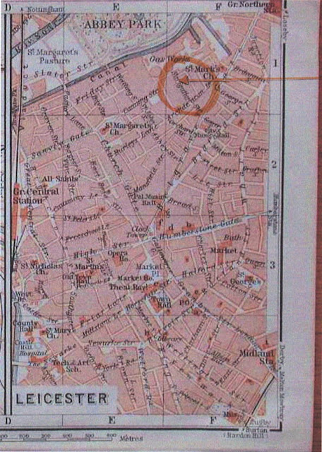
Map 4: showing Navigation Street St Margaret, Leicester where the Castings family lived according to the 1841 Census.
Map from Ancestry: Genmaps of Derby and Leicester.
Leicester town plan, 1900, Karl Baedecker in "Great Britain. Handbook for Travellers"
http://freepages.genealogy.rootsweb.ancestry.com/~genmaps/genfiles/COU_files/ENG/LEI/baedek_dby-lei_1900.htm
~~~~~~~~~~~~~~~~~~~~~~~~~~~~~~~~~~~~~~~~~~~~~~~~~~~~~~~~~~~
Map 5 showing Redcross street Leicester where Jane was living when taken to court.
Mike from Leicester, Rootschat.com
http://www.rootschat.com/forum/index.php?topic=389336.0


No comments:
Post a Comment